Exploration log0/26
—
Start exploring
43°41′N · 2°53′E

Demos

Four maps to explore.

Complete examples of what we build: a museum plan, a festival map, a territory atlas and a city map. Open them, click around, build your own route.

N° 01
Museum · 3D model

Palais Vernaud in 3D

The digital twin of a museum: three floors in 3D, hour-by-hour light, simulated visitors and an eye-level tour.

  • 3D model
  • Eye-level tour
  • Visitor flows
Open the demo
N° 02
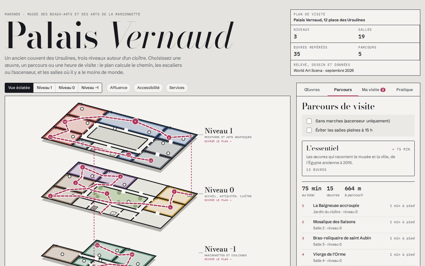
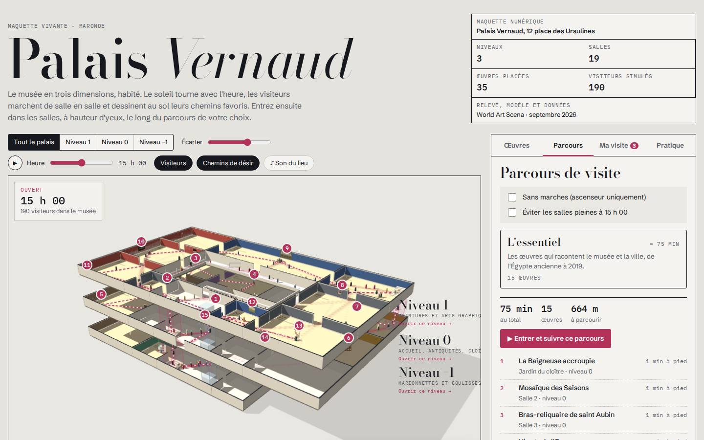
Museum · visitor plan

Palais Vernaud

The interactive plan of a three-level museum: visitor routes, highlighted works, hour-by-hour crowd levels and step-free routes.

  • Exploded view of the floors
  • Computed routes
  • Crowd levels and accessibility
Open the demo
N° 03
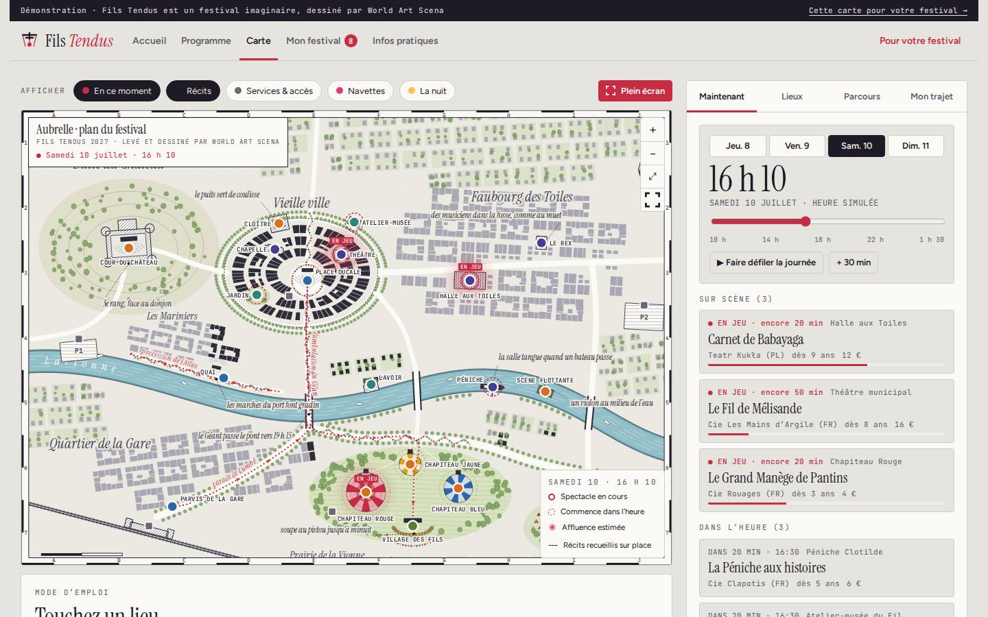
Festival · map and programme

Fils Tendus

A puppetry festival website: programme linked to the map, what is on right now, personal programme with walking times.

  • “Right now” map
  • Personal programme
  • Shuttles, services, night mode
Open the demo
N° 04
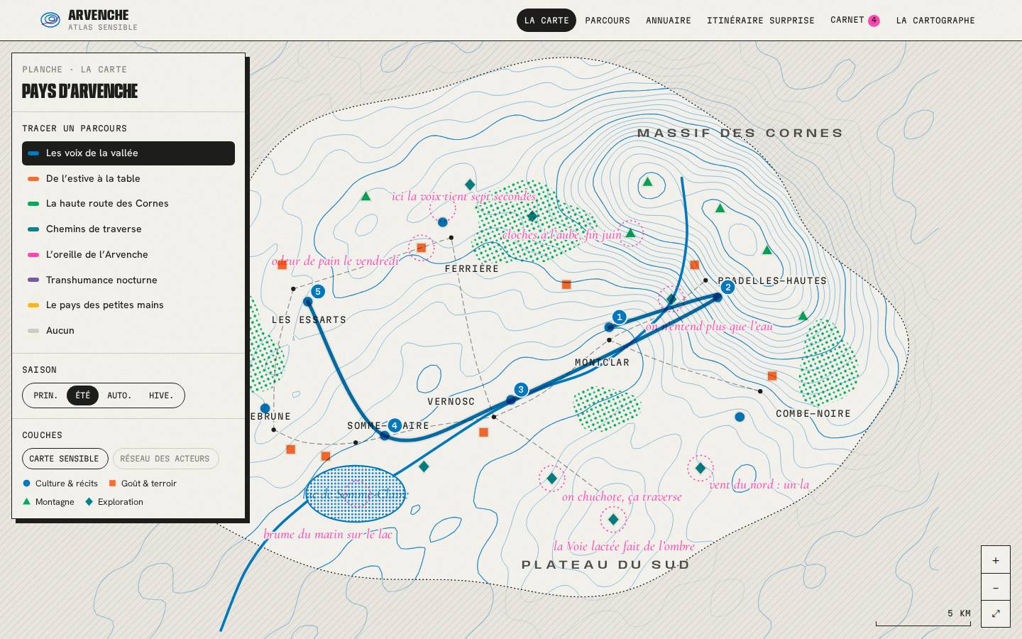
Territory · atlas and directory

Atlas de l’Arvenche

The sensory atlas of a valley: a living directory of places and people, seven routes, one map per season and a surprise itinerary.

  • Directory of recommendations
  • Routes with elevation profile
  • One map per season
Open the demo
N° 05
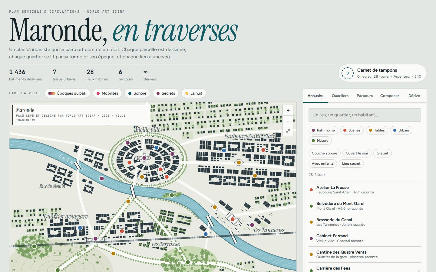
City · sensory map

Maronde en traverses

The map of a city read through its districts, its eras and its voices: directory, routes, custom walk, drift and stamp book.

  • Building eras
  • Custom walk
  • Stamp book
Open the demo

Our demos use fictional places, people and stories: our clients' data and their audiences' data are never published without their permission. The demos are in French; your map can be delivered in all five languages of this site.

Do you have a territory to reveal?

Tell us about your project. We reply within 2 working days with a first proposal.

Request a quote